Day 2: Asulkan Valley Trail: Glacier National Park
Day 3: Iceline Trail: Yoho National Park
Day 4: Abbott Ridge Trail: Glacier National Park
Day 5: Nakusp Hotsprings Trail
Day 3: Iceline Trail: Yoho National Park
Day 4: Abbott Ridge Trail: Glacier National Park
Day 5: Nakusp Hotsprings Trail
The valley feels enchanted. There is magic in the atmosphere."- Cartographer and explorer, Arthur O. Wheeler, 1905.
 |
| Run BC Crew running the rocky spines of Glacier National Park |
Run BC Project Day 2: Asulkan Valley Trail, Glacier National Park
Distance 14kms round trip, 7kms one way to the Asulkan Cabin lookoutElevation: start at 1245m-top out at 2114m, with about 900m of climbing/descending
Terrain: Non technical, with a section of ridge spine travel that will knock your socks off. Light to moderate incline for the first 4kms with a good 'stiff' climb and the majority of elevation crammed into the final 3kms to the cabin.
Pack: Bear spray (Grizzly central and the park rangers had an up to date sighting/trail closure map at the entrance the week we were there), camera, sunscreen (exposed), communication device (Delorme inReach) trekking poles if you need them for a short section on steep, loose terrain.
Map: Parks Canada
Glacier is a National Park for good reason! What a spectacular place to play and explore the mountains and forest of BC. I highly recommend that you stop here for an adventure next time you are in the area.
From the Parks Canada site:
"The park protects unique stands of old growth cedar and hemlock, and a great diversity of wildlife. Created in 1886 following the completion of the CPR's transcontinental line, the park enticed travellers to its uncharted wilderness and the area became the birthplace of mountaineering in North America. Trails leading to spectacular glacier viewpoints were laid out by the Swiss guides for their clients a century ago- and are still waiting for you to discover the magic of the Selkirks for yourself."
 |
| The trail begins on a cool forest path. |
 |
| Over the river we go. |
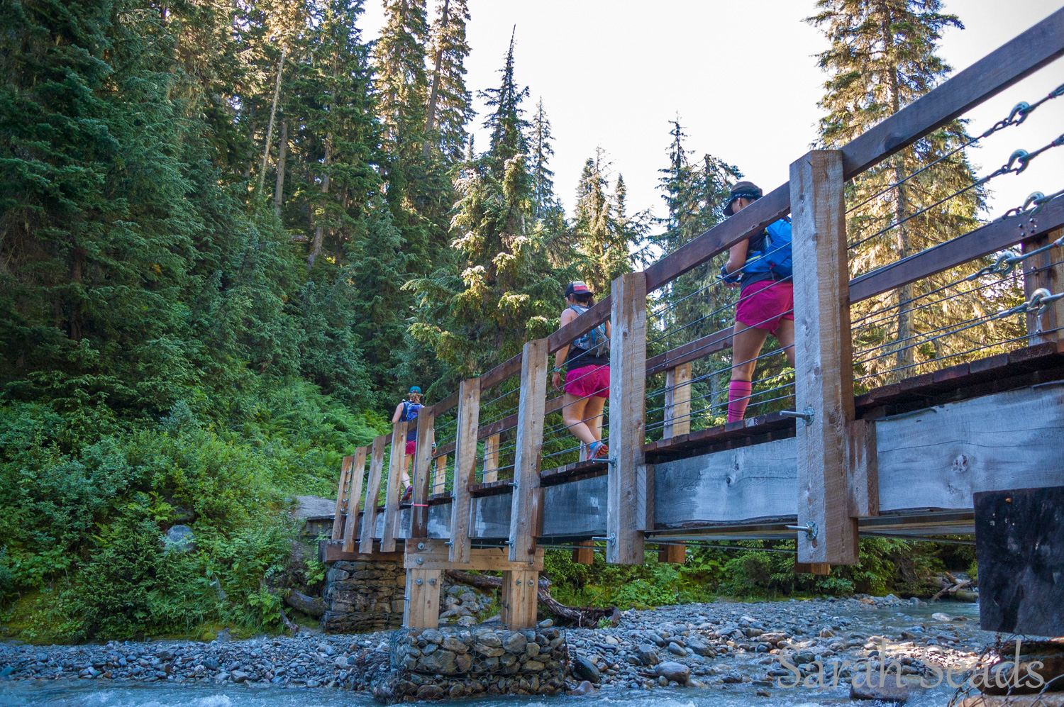
Day 2 of the Run BC Project began with a nice gradual climb in the shade of the woods from the Illecilliwaet trail head in Glacier National Park. The start of the trail passes through the ruins of the historical Glacier House, which was once the hub of mountaineering in Canada, with over 90 luxury rooms, and served as the inspiration for the design of the Chateau Lake Louise.
After a couple of kms in the cool forest, the trail pops out into the bright boulder fields, following a river that flows from the glaciers high above. The trail begins to climb more steeply at this point and the terrain pitches upwards, providing views of the mountains, glaciers, rock slides and beautiful waterfalls. The trail follows the left side of the fast flowing river and eventually crosses via a bridge to the other side.
 |
| Up the valley we go... |
 |
| This ridge spine was one of the unique features on this route and running it was definitely a highlight of the day! |
 |
| Views worth celebrating!! |
 |
| Sears catalogue pose;) Let's go up there next! |
Heading back the way you came, the ridge spine trail is surprisingly steep and can be slippery with loose, dusty dirt so be sure to pack trekking poles if you prefer them on steep, slippery terrain fyi. This is also Grizzly bear country, so be sure to pack your bear spray, travel in a group and check with Parks for updates on trail closures and warnings etc.
 |
| More epic views on the way back down the spine. |
 |
| Out and backs make for double the joy on a route like this one! |
Happy Trails!
No comments:
Post a Comment