 |
| Sun drenched bluffs and views that go on and on and on... |
Thank you for joining me on the #explorethevispine challenge! This year I will be running ultra sections of the Vancouver Island Spine Trail as a way to raise awareness, support and resources for VISTA, the amazing team behind this truly visionary, 700km trail. Be sure to check out the #explorethevispine page on this blog to find out more and to learn how you can join me in supporting this great cause.
My second adventure run on the Vancouver Island Spine Trail turned out to be a spectacular surprise. WOW! Just WOW! I officially have a new favourite trail. Yup. I have been on a few trails in a few places over the years and I am blown away that one of the most beautiful trails in the world exists right in my backyard...and I didn't even know it was there!
With snow still covering our Island ranges, I needed to choose another low-elevation section of the Spine Trail and I had my eye on the Port Alberni section. I had recently heard about the Alberni Inlet Trail and thought it would be fun to connect the dots from the Inlet to the foot of the Beauforts for my next leg. Heading from South to North Island, the Spine Trail will travel overland from the west shores of Lake Cowichan at the Nitnat River to the Alberni Inlet on a section known as the Tuck Lake Trail. This trail sounds beautiful and I am looking forward to exploring it later in the season, once the snow melts and the VISTA team has had a chance to clear the trail of recent logging and winter windfall.
I was in need of some local beta to determine the best way of connecting these two areas, as I wasn't sure which trails were currently accessible (windfall, logging, etc). A few emails later and I had the pleasure of connecting with two local Port Alberni ultrarunners and all around fantastic people, Jackie Windh and Dave Gilbert. Jackie and Dave write a blog and Jackie is (among many things) an adventure writer and author of the Running Ultramarathons blog as well. They travel around the world running all sorts of adventure Ultras and have many wild tales to share. They also know the Port Alberni trail networks like the back of their hand. Jackie and Dave were an invaluable resource in my research and planning to run this leg of the Spine Trail. Through our email conversations I learned that the 'Runners Trail' and 'Alberni Inlet Trail - Stage 3' sections of the Spine Trail are in need of some trail work and are not accessible at the present time. VISTA will be clearing and improving this section, along with a few others, this summer and they are currently recruiting volunteers. If you are interested in being part of the trail building team, please contact VISTA's volunteer co-ordinator Caroline Williams, for more info and to get involved...they need you.
Leg #2 Port Alberni Inlet to the Log Train Trail
Distance: 37kmsElevation: ______
Run Time: 4 hours 30mins. On trail time: 5 hours 30mins
GPS: TBA
*See individual leg descriptions below fore more detail
For this leg, I was lucky to have my friend Roanne along for most of the run and we squeezed in the adventure on our way down to Victoria for a weekend workshop. Nice to get a long run in before being locked in a classroom all weekend! We parked our car at the start of the Alberni Inlet Trail Stage 1, the trailhead closest to Port Alberni town on Ship Creek Road, and met up with Dave who then shuttled us out to the furthermost point on Stage 2 of the trail at Franklyn Creek. As mentioned, Stage 3 is currently not really accessible and Jackie and Dave recommended that we avoid it for the time being.
 |
| Magic forest light...a trail runners dream. Living it in real life! |
Alberni Inlet Trail Stage 2
Distance: 10kms
Elevation Gain: The total for Stage 1 and Stage 2 combined was 1200m fyi. (not 400m as the maps would like you to believe).
Run and Photos Time: 1 hour 10mins
Difficulty: Easy to Moderate
Terrain: Undulating single track with some short technical sections requiring scrambling over rock. Mostly easy, flowy beautiful singletrack.
Surface: Dirt, rock.
Users: Hikers, runners.
Highlights: Beautiful coastal forest, inlet views, rocky bluffs, wildflowers, waterfalls, coves, rivers, bridges, wildlife.
Access: North end China Creek Park. South end Franklyn River Road - Detailed directions found here.
 |
| Roanne (left), Dave (centre) and Me (right) at the south trailhead for Stage 2...thanks for the ride Dave! |
The trailhead at Franklyn creek (south end) boasts a great set of maps and the signage along the entire route was fantastic. Some serious work has gone into creating and improving this trail! We were so appreciative of the consistent signage and it correlated with the map quite well, which is so helpful in new terrain. There are even emergency location/marshal station markers along the trail at beach access points. The route begins on an old logging road and climbs uphill for about half a km through a clearcut before dropping into the singletrack on the leftside. That is when the beauty begins!
 |
| Waterfalls oh my! |
 |
| Lush coastal forest for days. |
 |
| Rare Chocolate Lily sighting! |
 |
| Pieces of the Islands history are found all along this trail. |
Distance: 14kms
Run & Photos Time: 2 hours 30 mins
Difficulty: Moderate with some steep climbs
Terrain: Undulating single track with some technical sections requiring scrambling over rock or using a rope. A couple of good climbs including one big trek up 300metres to 'The Lookout'- well worth the climb! Mostly undulating beautiful singletrack.
Surface: Dirt, rock.
Users: Hikers, runners.
Highlights: Big 'lookout view', beautiful coastal forest, inlet views, rocky bluffs, wildflowers, waterfalls, coves, rivers, bridges, wildlife.
Access: North end Ship Road. South end China Creek Park - Detailed directions found here.
 |
| One of my absolute favourite things in life... |
Stage 1: Once the world finds out about this trail, it won't be a secret for long! Most of this trail travels through working forest, with only three very short sections of logging road. It really is point to point, single track heaven. This Stage has more elevation change than Stage 2, but the views are always worth the climbs.
 |
| Crossing beautiful China Creek |
The Stage 1 trail (continuing from south to north) begins by touring through the lush forest of China Creek regional park. Wow! Dropping down to the Creek is a magical journey through more fantastic coastal forest, waist deep ferns and an explosion of green life. The spring show is spectacular on this trail! Soon the trail arrives at China Creek and crosses a bridge over to the other side. What a beautiful river. Deep pools of aqua marine water, and easy access to perfect swimming holes, make this a must 'dip' spot on a hot summer day. I can't wait to go back and cool off in these pools this summer!
 |
| China Creek swimming pools...I can't wait to go back for a dip! |
 |
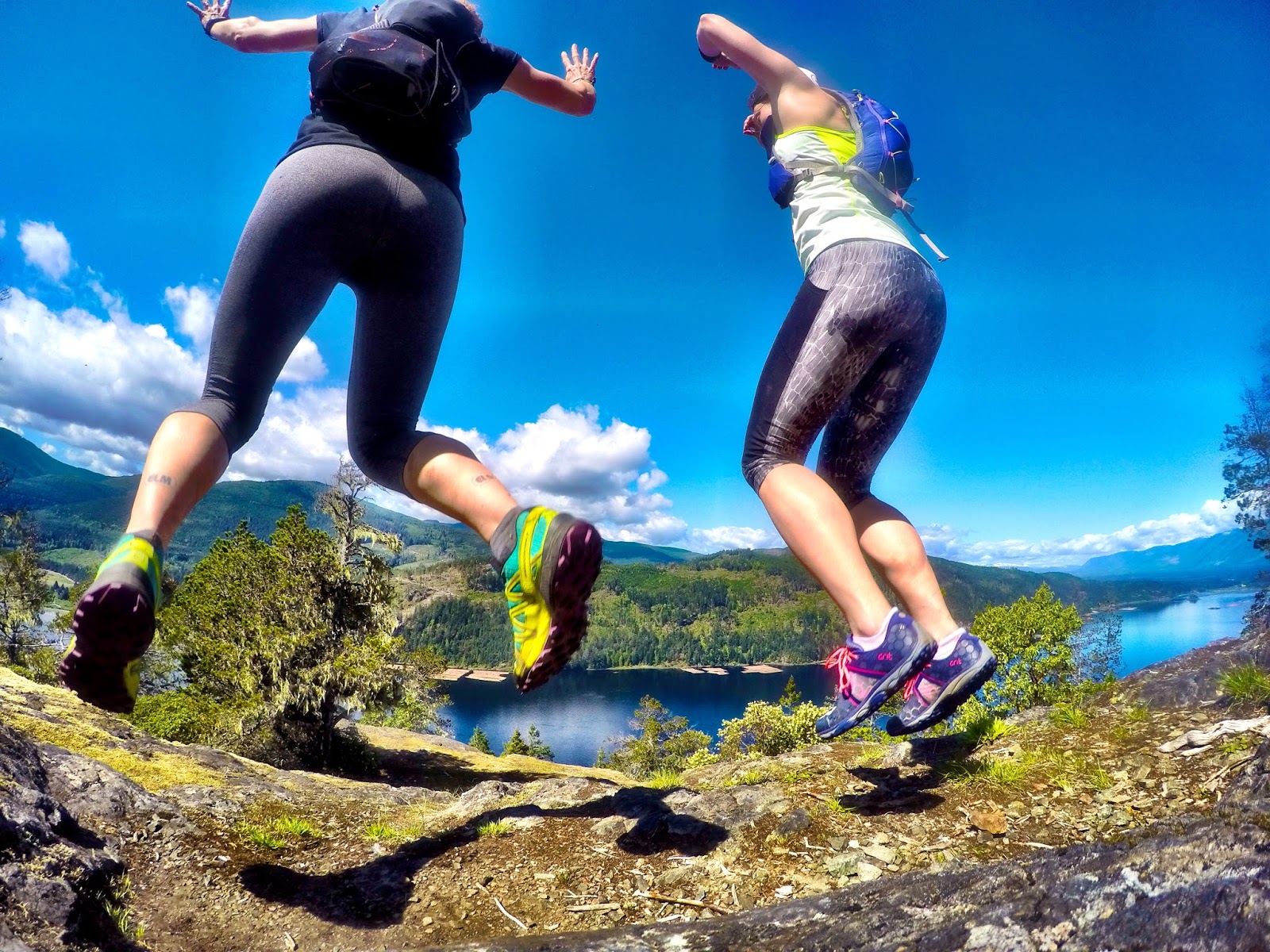
| A little trail love is worth leaping for! |
At a narrow point on the Inlet (Stamp Narrows), the trail pops out at 'Lone Tree Point' a lovely spot beside a lighthouse marker. We stopped to take a photo, of course, and hit the deck when a massive young eagle nearly grazed the tops of our heads en route to his fishing hole. Swooping down right in front of us with talons out to reach for his catch. A-Mazing. Again. Geez, this trail doesn't know when to quit. Love it!
 |
| Come ON!!!!!! The photo ops just don't stop! Spring wildflowers line the trail...Alberni Inlet in the background. |
 |
| Views for days... |
A lovely spot for a day hike from the north trailhead at Ships Creek Road, our new friends Jackie and Dave often head out the lookout for a short run or even dinner with a view. What a special place. I can't wait to go back...and I plan to enjoy many sunrises and sunsets here!
 |
| Tadaaaaaa! We made it to 'the lookout'! And we should be wearing shorts! So hot for April! |
Port Alberni Community Trail
Distance: 10kms from Ship Creek Road to the Log Train Trail entrance on Mozart road
Our
car was waiting for us, but I had a few more miles to go. I was
excited to find out how the trail connected from Stage 1 to the Log
Train Trail and to explore Port Alberni's urban trail network. It did
not disappoint.
When travelling northward, cross Ships Creek Road and head into the signed trailhead directly ahead, about 75metres from the parking lot. Once you head into the singletrack turn RIGHT at the first fork (I went left, it heads into a neighbourhood fyi) and go UP a nice big hill. Soon you will reach another fork - turn LEFT and stay on the main trail for more UPhill. From here the trails are quite well marked! Look for signs to 'Argyle St Trailhead' and eventually even 'Log Train Trail'. The trail climbs up a bit further before flowing down the other side, on a wide double track dirt trail (old road) passing side trails that head into various neighbourhoods. It is an awesome urban trail network that connects many areas of the town! When you can see the Rugby fields on your left, be sure to stay LEFT- there is no sign indicating this so keep your eyes peeled and stay close to the fields to avoid going off track. The trail wraps around the Rugby field and clubhouse and then crosses Argyle St (another great trailmap kiosk here) before connecting to another section of this great trail network through town. Behind some homes, the trail drops into a lovely shaded ravine- Dry Creek Ravine Park- crossing a bridge and heading back up the other side under the cover of a gorgeous Maple tree forest. I can only imagine how lovely it is there in the fall!  |
| Port Alberni Community Trail Map |
 |
| Maple magic. I love spring! |
 |
| Secret trails of Port Alberni...right by the Highway! |
I was stoked to see both Roanne and our new local friends Jackie and Dave waiting to greet me at this trailhead! I spent 20 minutes chatting with the gang, getting in a short visit (as we would be leaving town immediately after the run) and picking up some beta for the final leg to the LTT. It was smokin hot and I wanted to get on with the run, so I pulled myself away and eased my legs back into running after a very long pit stop- hard to do! On the Log Train Trail- hurray! Although the LTT map starts counting kms further up ahead, the section of trail from Estevan is in-fact, part of the LTT as well. Flat railway grade, with lovely pieces of single track that wind away from the grade, made this section a nice easy way to stretch out the legs. The trail crosses Rogers Creek (look for a bridge just to the left to keep your feet dry!) just before reaching Highway 4. Crossing the highway carefully (use caution here!), I continued northward on Maebelle Road for my only real section of road on this entire arun! Just 1.5km of road on this half day adventure crossing through Alberni town- what a great community trail network!
Alberni Valley Log Train Trail
8kms to McLean Sawmill National Historic Site and foot of the Beaufort range, from the Mozart Road trailhead ( I timexed after 3kms boohoo!).
Map
I made my way into the Equestrian trail by turning left at the end of Maebelle Road onto Mozart Road and entering the trail on the right side (could have just gone straight into the trail at the end of Maebelle Road but the Equestrian trail was a nice singletrack addition) and after about one kilometre or so, I found myself on the LTT as I remember it. In previous years I have coached many summer trail running clinics for my ELM athletes, training to race in the Log Train Trail Half Marathon. Although this race no longer exists, I have years of great memories full of runs and laughter and celebrations on this trail. The wide, flat railgrade trail travels through working forest and horse country, with many signs of industry and quadzilla adventures along the way.
 |
| Log Train Trail is straight and true. |
The LTT travels 21kms from the Mozart trailhead to Woolsey/Somers road and it is an awesome route for bikers, hikers and horse back riders alike. It crosses lovely rivers and travels through the McLean Sawmill National Historic Site. The Mill Site is the point where the Spine Trail will leave the Log Train Trail and head up up up into the Beaufort mountain range and north to the Village of Cumberland. I am SO looking forward to exploring this back country section of the Spine Trail, once it is completed. For this current leg, however, I pulled the pin at km 3 on the LTT as we had run out of time and we had to get on the road to Victoria. 37kms and 4.5hours of running time/5.5hours of adventure time, we had run through a beautifully diverse range of terrain and I was so happy to have connected the dots from the Alberni Inlet to the LTT!
 |
| We LOVE the view from 'the lookout'!! Port Alberni town to the right. |
There is a real goldmine of trails waiting in Port Alberni. I believe I only just scratched the surface of what this beautiful area has to offer. In fact, this new 'Valley of Trails' website confirms my suspicion.
As for the Spine Trail route from the Inlet to the LTT, I encourage you to get out and explore part or all of this section if you can! You can tackle it in short pieces or make one big adventure out of it all. You can go for an out and back or set up a shuttle and point to point it. You can spend the day at China Creek Regional Park with the little ones, or take your family on a big climb up to 'the lookout' on the Stage 1 trail. You can ride your bike across town on the urban trails or ride your horse for miles on the Log Train Trail. There are so many ways to enjoy this great trail network and I hope that you will add this area to your own #explorethevispine challenge!
See you on the trail!
SS
5 comments:
Wow, that's amazing. Would be kinda cool to also acknowledge the traditional territory of the Indigenous people :) you run through.
Yup... you only scratched the surface (although perhaps some of the prettiest sections of the surface!).
We have LITERALLY 100s of kms of running trails here in Port Alberni... once you connect loops via the logging roads. We are out on them nearly every day.
Dave and I are planning to hike/run Della Falls (highest waterfall on the whole CONTINENT!) next week... and that's just ONE of our amazing local adventures planned for this summer.
SO glad you guys had such a lovely day to do your run! Come back soon!
Jackie (and Dave)
Love your enthusiasm! So glad you enjoyed the trails.
Just wanted to let you know that the mountains you saw from the lookout in Stage 1 are actually in your own back yard--Comox Glacier, Red Pillar, and friends.
A very impressive run and a great write-up.
Anyonymous- thank you for stopping by to read and comment! I was thinking the exact same thing! I will take your suggestion to heart and do some digging to add to my #explorethevispine journey- thank you!
Jackie- thank you for being part of our journey! Such a great resource- I can't wait to come back and explore with you and Dave!
Towhee- thank you for stopping by and for your insight! Well, that makes sense! I will update the blog with that info on the mountains! Thank you!
Awesome! I will have to try this soon!
Post a Comment